Backpack-to-Baseline Environmental Intelligence

Turn a five-minute drone flight into orthomosaics, environmental screening, GIS packages and stakeholder-ready deliverables - in approximately five minutes of local processing.

Works with the drones you already own: DJI Neo 2Mini 4 ProAir 3Mavic Series
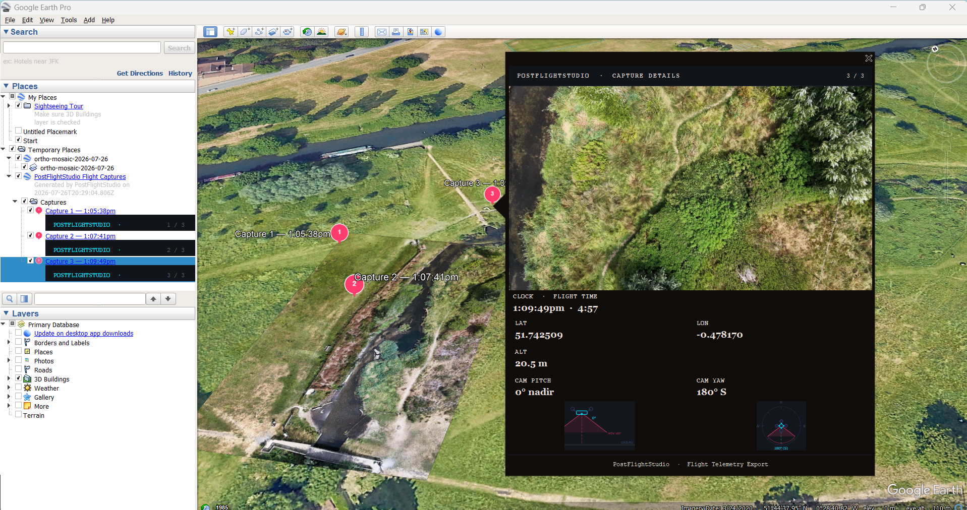
Google Earth Preview
Explore Survey Types: Woodlands / Heathlands / Rivers & Riparian
Habitat Capture Engine

Built for Environmental Field Surveys

Instantly ingest raw 4K MP4 flight footage and telemetry SRT files from your backpack drone. Stitch high-precision orthomosaics with complete altitude gradients and camera FOV overlays - entirely offline in your browser.

Immediate Field Deliverables

From Flight to Client-Ready Assets in 5 Minutes

Ecological Orthomosaic Maps

Top-down maps paired with PGW world files for seamless integration into QGIS and ArcGIS.

Google Earth Pro Integration

Export KMZ packages featuring clickable visual overlays, altitude, pitch, yaw, and FOV cones.

Professional PDF Reports

Structured summary reports containing survey boundaries, keyframe captures, and logs.

Client-Ready Presentation Decks

Formatted PowerPoint slides with map overviews and telemetry callouts for project briefings.

Flight Time
~5 mins
Processing
~5 mins
Cloud Uploads
0 (100% Local)
GIS Outputs
PNG, PGW, KMZ

Five-minute flights. Five-minute processing.

Most environmental mosaicing workflows take hours. PostFlightStudio is designed to produce field-ready outputs before you drive home.

Unified Platform Architecture

Modular Intelligence for Environmental Teams

PostFlightStudio Core

Capture & Stitch

Local browser-based processing engine turning consumer drone footage into high-precision, repeatable orthomosaics with zero cloud upload.

  • Local hardware processing (100% secure)
  • Timeline navigation & FOV cone overlay
  • Altitude gradient path & click-to-jump video linking

EcoSite Module

Contextualize

Instantly connect your spatial survey data to ecological context during site visits.

  • SSSI awareness & Impact Risk Zone checks
  • Ancient Woodland & Priority Habitat awareness
  • Preliminary spatial context and pre-app mapping

GIS & Evidence Suite

Export & Share

Package your findings into standardized GIS files and professional stakeholder communication assets.

  • Google Earth KMZ with clickable visual overlays
  • Automated PDF survey reports & audit trails
  • Client-ready PowerPoint decks and MP4 highlight reels
From Flight to Baseline

See the Workflow in Action

[ Click to View Demonstration ]
1

Fly

Hike out with a lightweight consumer drone and capture local habitat footage.

2

Create Environmental Deliverables

Process your survey data locally and generate comprehensive spatial assets and visual summaries.

3

Export KMZ & World Files

Open high-resolution spatial maps and telemetry directly in Google Earth Pro.

4

Generate Evidence Pack

Instantly package PDF reports, PPTX presentations, and video reels for stakeholders.

Field Proven Case Study

River Restoration & Longitudinal Tracking

Tested across active chalk stream and heathland restoration sites (including the River Bulbourne and Nomansland). PostFlightStudio allows practitioners to establish high-fidelity spatial records and return months later to verify habitat change.

Leave site visits with a repeatable ecological baseline before you've even taken your wellies off.

Join the Closed Beta

Join the first cohort of environmental practitioners, consultancies, and research bodies helping shape PostFlightStudio.

🔒 100% Offline Processing. Zero data uploaded to cloud servers.

⚡ Application Received!

We will be in touch shortly regarding your closed beta access.