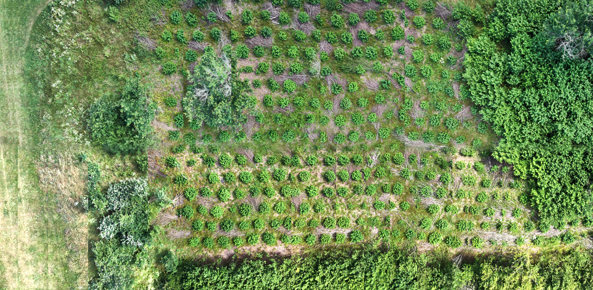
If you have ever landed a drone after a quick flight and wished you could immediately inspect your coverage as a seamless map without waiting hours for cloud processing queues or heavy photogrammetry suites, you are not alone. Turning standard aerial video into a clean orthomosaic is one of the most common challenges faced by field surveyors, land managers, and ecologists.
Can You Make an Orthomosaic from Drone Video?
Yes. PostFlightStudio generates true georeferenced orthomosaics directly from video files. Structurally and visually, the output is an overhead orthomosaic with correct geometric projection and world files ready for GIS software.
The difference lies entirely in the pipeline. Traditional photogrammetry requires uploading hundreds of high-resolution RAW stills into heavy point-cloud solvers. In contrast, our workflow extracts sequential frames from standard consumer drone MP4 recordings, associates them with embedded SRT telemetry subtitles, and assembles them locally in minutes.
Important: While the resulting file is a fully georeferenced orthomosaic, its absolute positional accuracy relies on the drone's onboard GNSS data rather than ground control points (GCPs). It is optimized for rapid environmental intelligence, field scoping, and habitat baselines rather than engineering-grade topographic surveys.
What You Need
You don't need an expensive enterprise mapping platform or a workstation cluster to build a high-clarity orthomosaic. The core requirements include:
- A Consumer Drone: DJI models (such as the Mini, Mavic, or Air series) that record standard MP4 video alongside companion subtitle telemetry files.
- Video Footage (MP4): Clean aerial video recorded with consistent downward or oblique gimbal angles.
- Telemetry Data (SRT): The subtitle files automatically generated alongside your video, containing critical timestamp, GPS coordinate, altitude, and orientation logs.
- A Local Computer: A standard local machine running desktop tools to stitch frames entirely offline.
- A Structured Flight Pattern: A planned flight path ensuring adequate visual overlap across your survey area.
How to Capture Drone Video for Mapping
The speed and stitching quality of your orthomosaic depend directly on how you fly your survey block. Matching your flight pattern to the habitat geometry prevents distortion and stitching tearing.
Linear Transects (Rivers, Streams, and Linear Features)
Best for long, narrow environmental features such as chalk streams, river corridors, drainage channels, hedgerows, or fence lines. Flying a steady, continuous pass along the watercourse captures sequential video frames and linear telemetry that assemble into an elongated spatial record.
Grid / "Mow-the-Lawn" Surveys (Broader Habitats)
Best suited for expansive blocks of terrain, such as lowland heath reserves, woodland compartments, restoration sites, or agricultural plots. By flying parallel overlapping flight lines back and forth across the area, the drone builds complete areal coverage across the target polygon.
Why Overlap Matters
Just like traditional photogrammetry, video-based orthomosaic stitching relies on visual feature matching between frames. Maintaining consistent flight speed, steady gimbal pitch, and adequate lateral overlap between parallel legs ensures the processing engine can bridge frames without warping textures.
How to Turn DJI Video into an Orthomosaic
Processing video feeds locally rather than uploading massive multi-image sets transforms the workflow into a streamlined sequence:
- Capture: Record flight video and SRT telemetry using your portable backpack drone.
- Frame Extraction: Ingest the MP4 file and extract key video frames at calculated time intervals based on flight speed.
- Telemetry Parsing: Read the SRT subtitle data to associate every extracted frame with its approximate spatial positioning.
- Stitching: Blend frame borders dynamically to eliminate seamlines and normalize lighting variations.
- Georeferencing: Generate accompanying world files alongside the high-resolution orthomosaic image output.
- Export: Package outputs into formats ready for desktop GIS environments.
What Is a DJI SRT File?
An SRT (SubRip Subtitle) file is a text log generated automatically alongside DJI video recordings. While traditionally used to display subtitles on video players, for spatial mapping it serves as an invaluable telemetry record containing:
- Timestamps: Timing markers matching the video stream.
- GPS Coordinates: Latitude and longitude logs corresponding to the drone's flight path.
- Altitude Data: Height above takeoff point or ellipsoid height.
- Gimbal & Orientation: Camera pitch, roll, and yaw parameters during recording.
Pairing your MP4 video with its companion SRT file allows local software to calculate spatial transforms without requiring manual ground control point (GCP) tagging for preliminary baseline mapping.
Can You Make an Orthomosaic from an MP4 File Alone?
Yes, but an MP4 file on its own is merely a visual recording. To turn raw MP4 footage into a georeferenced orthomosaic, the file must be accompanied by its telemetry log (such as an SRT file or flight log). Without telemetry data linking pixels to real-world coordinates, video frames cannot be placed onto a spatial grid.
Real-World Examples from Ecological Surveys
Different ecosystems present unique visual textures—from closed-canopy forest structures to complex dwarf-shrub heath matrices and winding river corridors. Below are actual orthomosaic outputs generated from consumer drone video across varied environments in our own field testing:
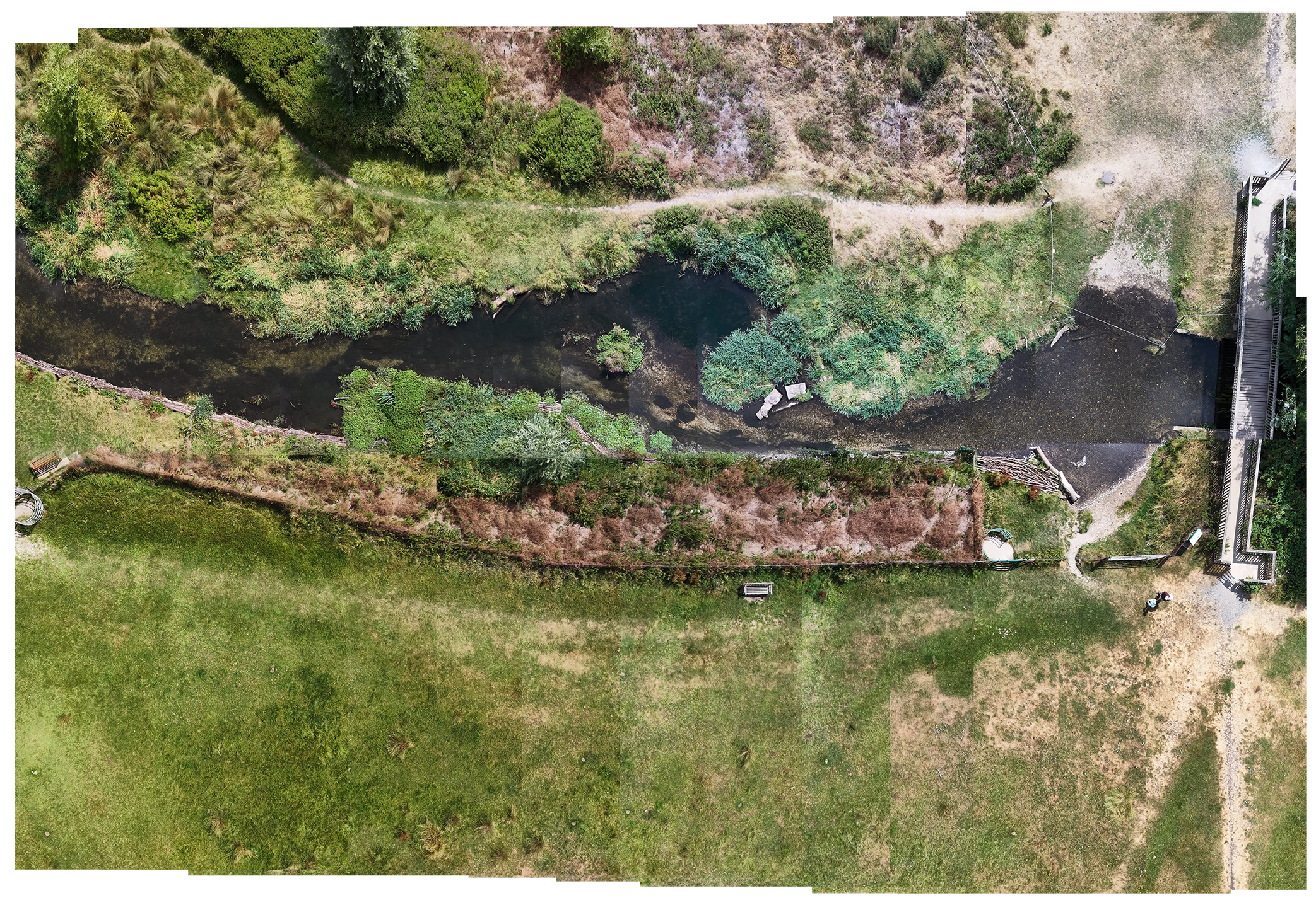
Linear transects mapping bankside vegetation, channel margins, and restoration progress.
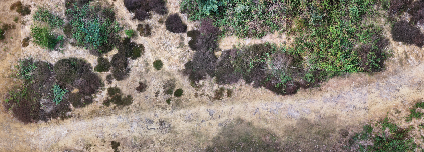
Area coverage mapping heather canopy health, bare ground, and scrub encroachment.
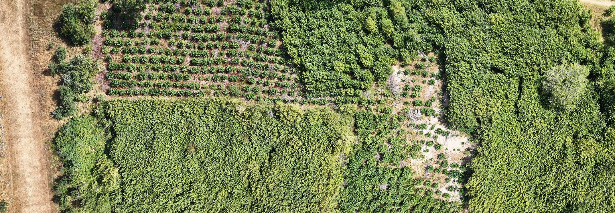
Rapid orthomosaics detailing rides, clearings, and tree canopy structure.
Video Workflow vs. Traditional Photogrammetry
These workflows solve fundamentally different problems. Rapid video-derived orthomosaics aren't a replacement for survey-grade metrology; rather, they occupy a different tier of field utility:
| Metric | Traditional Photogrammetry | Rapid Video Workflow (PFS) |
|---|---|---|
| Data Input | Hundreds of high-res still photos | MP4 video + SRT telemetry |
| Processing Setup | Image alignment, GCP tagging, point clouds | Automated local frame extraction & stitching |
| Processing Time | Hours to days (often cloud-queued) | Typically ~4 minutes locally |
| Primary Output | Survey-grade ortho, DSM, 3D mesh | Rapid georeferenced orthomosaic & GIS files |
| Best Suited For | High-precision engineering & volume calc | Rapid field intelligence, scoping & monitoring |
Can You Create Orthomosaics Without Cloud Uploads?
Yes. For environmental professionals working in remote areas or handling sensitive site records, local desktop processing offers distinct operational advantages:
- Data Privacy: Some organizations prefer to keep raw environmental imagery, site notes, and survey boundaries entirely on local hardware rather than uploading gigabytes of files to external cloud servers.
- Field-Ready Speed: Generate orthomosaics immediately after landing in site offices or vehicles without relying on patchy cellular broadband connections.
- Streamlined Workflows: Bypass complex multi-software toolchains when you only need an immediate visual baseline to inform ongoing fieldwork.
Using Orthomosaics in QGIS and ArcGIS
Once your rapid orthomosaic and GIS packages are generated locally, they integrate smoothly into standard desktop GIS toolchains:
- QGIS & ArcGIS: Drop your image and world files straight into your desktop GIS project for spatial overlay analysis and vector digitising.
- Google Earth Pro: Open KMZ packages featuring clickable visual overlays, telemetry logs, and flight paths.
- Stakeholder Reports: Embed clean aerial overviews and keyframe captures into client reports and briefing presentations.
- Longitudinal Comparison: Return months later, fly the exact same transect, and visually verify habitat change over time.
Frequently Asked Questions
Yes. By extracting sequential frames from consumer drone MP4 video files and pairing them with SRT telemetry data, local software can stitch and georeference an orthomosaic in minutes.
By ingesting the MP4 recording alongside its companion SRT subtitle file, processing engines parse the GPS timestamps, position the sequential video frames, and stitch them into a continuous orthomosaic grid.
Yes, provided the MP4 is accompanied by telemetry data (such as an SRT file) logging the camera's positional coordinates and altitudes during flight.
An SRT (SubRip Subtitle) file is a text log generated alongside DJI video recordings that stores real-time flight telemetry, including timestamps, GPS coordinates, camera tilt, and altitude.
No. While survey-grade photogrammetry uses GCPs for absolute millimeter precision, rapid video-derived orthomosaics rely on onboard drone GNSS telemetry for immediate relative positioning without manual ground markers.
Yes. Local processing tools run entirely on your desktop machine, keeping all imagery secure and accessible offline without internet connectivity or cloud queues.
No. Video-derived orthomosaics are designed for rapid site scoping, ecological baselines, and preliminary assessments rather than engineering-grade topographic surveys.
Want to try the workflow?
PostFlightStudio is currently being developed for environmental practitioners, surveyors, and drone operators who need rapid local orthomosaic processing without uploading their imagery.
⚡ You're on the list!
We will be in touch shortly regarding your closed beta access.