Why are lowland heath habitats difficult to map?
Lowland heath is an internationally rare and fragile habitat, but managing it presents unique ecological surveying challenges. Dense heather (Calluna vulgaris) can create repetitive textures, while wind-driven vegetation movement also makes image matching more challenging for conventional photogrammetry workflows. Furthermore, scrub boundaries change every year as birch, pine, and invasive gorse aggressively colonise open stands and choke out valuable dwarf-shrub communities.
Traditional foot surveys across boggy terrain or rolling hills are notoriously slow and labour-intensive, while freely available satellite imagery is often outdated and lacks the spatial resolution required to spot early-stage scrub or assess delicate heather canopy health. Conservation teams need high-resolution, repeatable baseline data that can be gathered quickly during a brief weather window.
By capturing lightweight drone video feeds and processing them locally, beta users can perform a thorough drone heathland survey without relying on heavy enterprise hardware or internet connectivity in remote field stations.
Lowland heath supports specialized species such as Nightjar, Woodlark, Dartford Warbler, Silver-studded Blue butterfly, Sand Lizard and Smooth Snake, all of which benefit from careful habitat management and sensitive wildlife surveys.
Monitoring habitat change over time
Heathland management is rarely about a single snapshot. Reserve managers need to compare conditions across months and years to assess scrub encroachment, gorse expansion, grazing pressure, wildfire recovery and heathland restoration projects. PostFlightStudio makes consistent repeat surveys straightforward, allowing beta users to fly the exact same transects season after season and quantify ecological changes with real-world geospatial precision.
Why conservation organisations prefer local processing
When conducting a heathland survey across protected reserves, data security and confidentiality are paramount. Conservation sites frequently host sensitive Schedule 1 bird nesting territories (such as Nightjars, Woodlarks, and Dartford Warblers), rare reptile populations, and vulnerable protected species records that cannot ethically or legally be uploaded to third-party cloud servers.
Because PostFlightStudio runs entirely offline on your local desktop machine, there are zero cloud uploads. Field teams can process high-resolution drone heathland mapping right in remote site offices or mobile field units without requiring an active internet connection—ensuring sensitive species locations and reserve telemetry remain strictly confidential under your direct control.
Common applications
Typical uses across wildlife trusts, conservation bodies, and ecological consultancies include:
The heathland survey workflow
1. Fly your reserve
Fly your designated lowland heath block or moorland transect using a compact consumer drone like a DJI Mini or Mavic.
2. Process locally
Drop your MP4 and SRT files into PostFlightStudio. Your data remains fully secure on your desktop.
3. Export deliverables
Generate orthomosaics, GIS-ready outputs and Google Earth KMZ overlays in minutes.
Outputs generated from a typical survey
During a typical heathland survey, PostFlightStudio produces several outputs that can be used immediately in ecological reporting, stakeholder engagement and long-term monitoring.
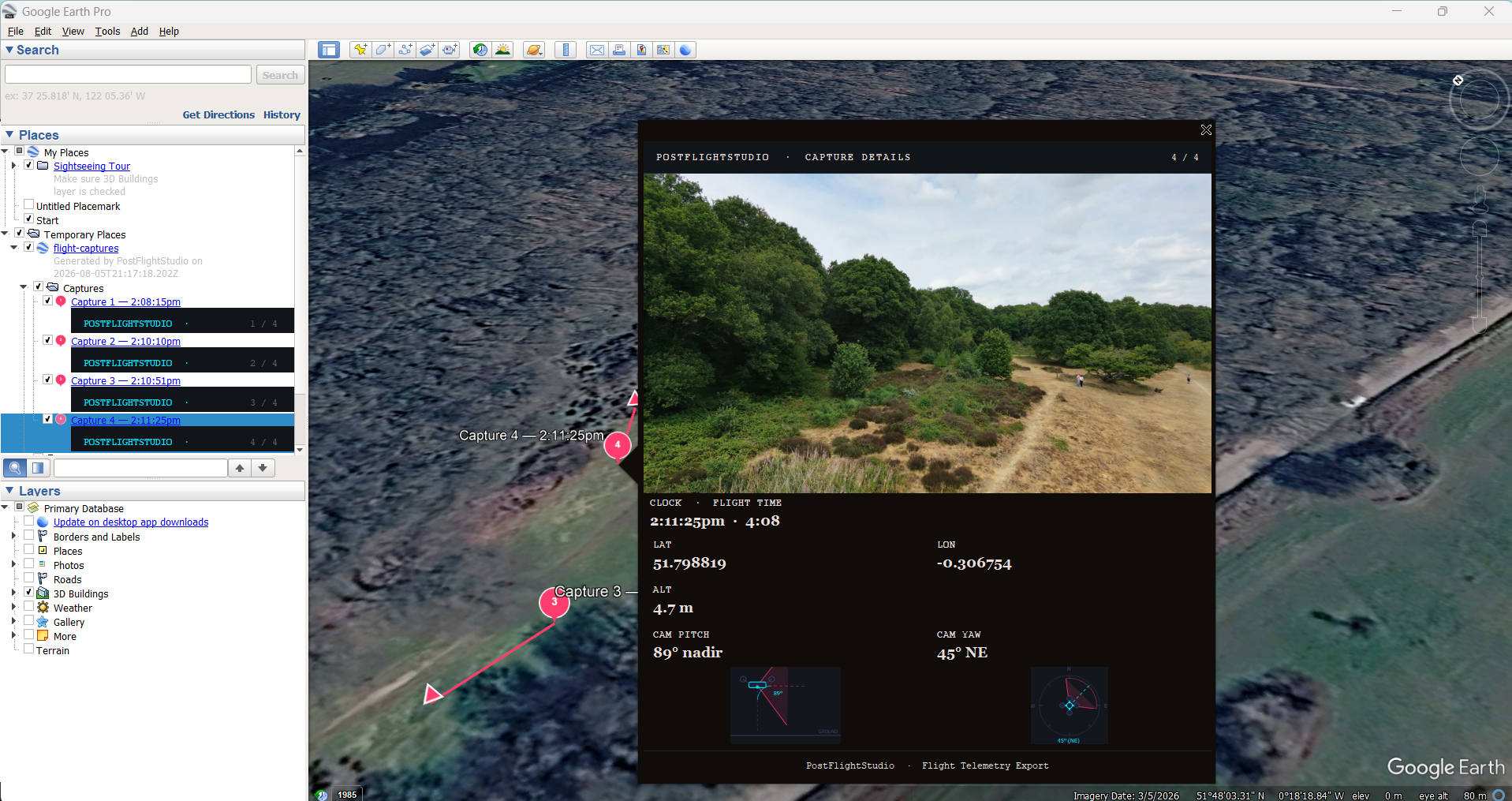
Google Earth Pro telemetry view with directional heading markers for exact field snapshots.
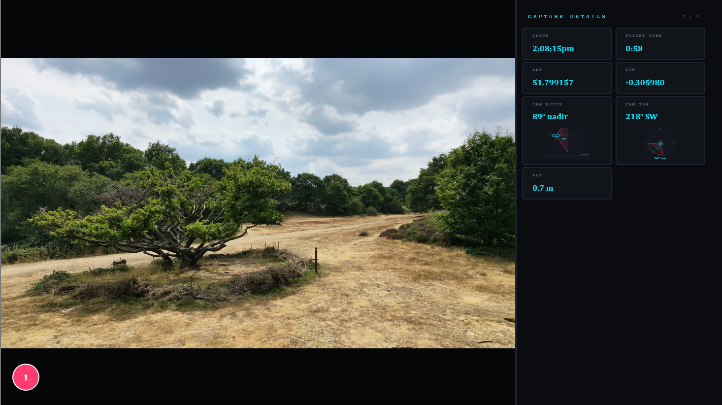
Professional presentation summarising habitat survey created in seconds.
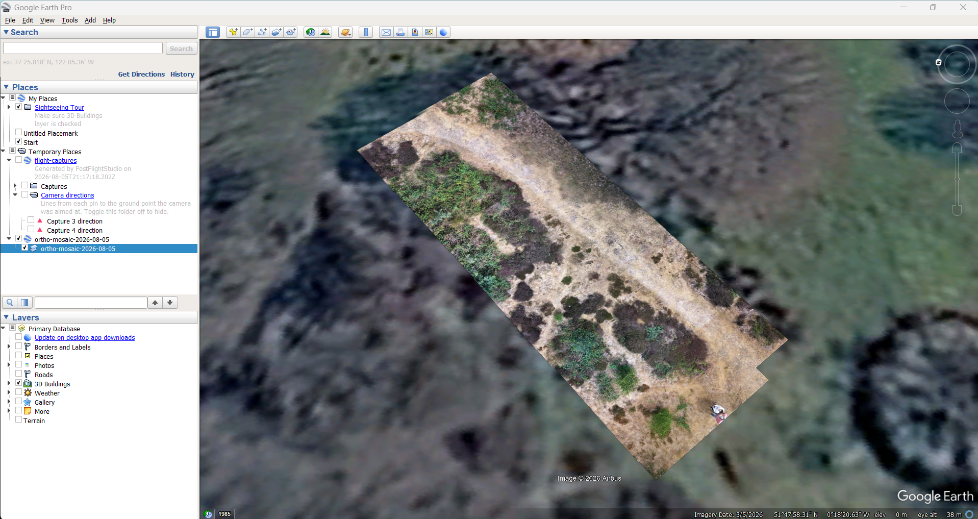
High-resolution map displayed in Google Earth Pro to track heathland changes over time.
Frequently Asked Questions about lowland heath drone surveys
Yes. PostFlightStudio is designed to process standard MP4 and SRT telemetry from compact drones like the DJI Mini or Mavic series, allowing reserve wardens and ecologists to rapidly run a heathland survey without heavy enterprise hardware.
By parsing video frames alongside GPS telemetry, the workflow allows beta users to build high-resolution local orthomosaics that clearly reveal pine wildings, birch regeneration, bracken spread, and invasive gorse patches across expansive heather stands.
Yes, local drone surveys before and after controlled rotational burns allow conservationists to accurately calculate burnt surface areas and monitor subsequent heather regeneration.
Because processing is tied directly to high-precision drone telemetry embedded in the flight video, local orthomosaics provide consistent spatial context suitable for habitat boundary mapping and supporting SSSI condition assessments.
Yes. Flights can be exported instantly as KMZ packages containing interactive pins, flight paths, and snapshot markers for easy review in Google Earth Pro.
Completely. PostFlightStudio runs entirely offline on your desktop machine, meaning you can process drone heathland surveys in remote field offices without reliable broadband.
Any DJI drone that records standard MP4 video alongside embedded SRT subtitle telemetry (such as the Neo2, Mini, Air, and Mavic ranges) is fully supported.
Yes. By keeping flight parameters consistent or referencing previous flight logs, reserve managers can perform repeatable annual monitoring to quantify long-term ecological change.
Yes, the offline local workflow is specifically designed to let conservation teams archive and compare multi-year orthomosaics to track long-term habitat recovery and invasive species spread.
Join the Closed Beta
Join the first cohort of conservationists, wildlife trusts, and ecologists helping shape PostFlightStudio for lowland heath and habitat mapping.
⚡ Application Received!
We will be in touch shortly regarding your closed beta access.