3D Habitat Models

NewHTML · KMZ · GeoTIFF · VideoLicence

An interactive 3D model of the site, built from a straight run of drone video. The height of trees, scrub, hedges and bankside vegetation comes from how fast each feature moves past compared with the ground - no separate mapping mission.

  • Shareable 3D model: one HTML file anyone can open and explore - location can be left out for sensitive sites
  • Google Earth Pro KMZ: the model standing on the site
  • GeoTIFF height map for QGIS and ArcGIS
  • Orbit video for presentations and social media

Use it to: show habitat structure - canopy height, scrub, bankside cover - to people with no GIS software.

Heights are approximate. Best from straight legs flown at a steady height and 2 m/s or faster, camera pointing straight down.
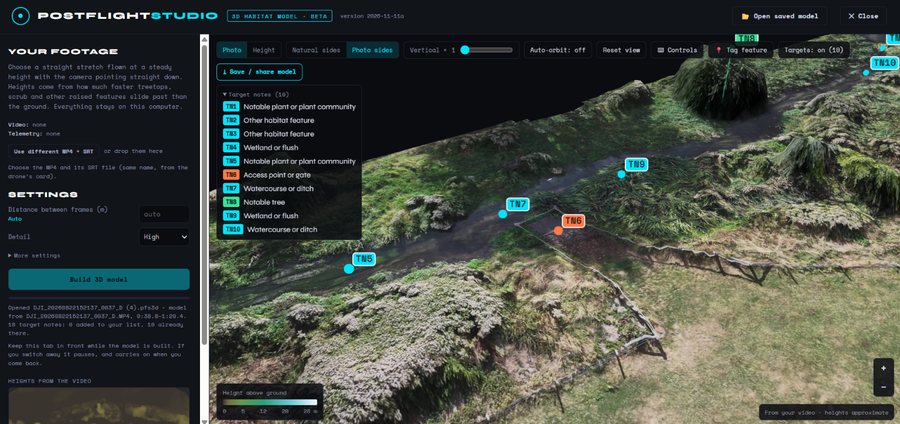
Ten numbered target notes on a 3D habitat model of a stream and its banks, with their listClick to enlarge

Target Notes

NewKMZ · PDF · PPTX · CSV · GeoJSON · SHPLicence

Label environmental features where you find them - on a captured video frame, on the map or straight onto the 3D habitat model. Each becomes a numbered target note (TN1, TN2 ...), as in a Phase 1 habitat survey, with its category, OS grid reference, height above ground, aspect, suitability, recommended action and the drone's own pictures as evidence.

  • Six categories: bat potential roost features (with PRF-I, PRF-M and FAR suitability), trees and deadwood, protected species signs, invasive non-native plants, habitat target notes, and site and management
  • Sensitive species protected: setts, nests and holts are left out of shared files unless you choose to include them
  • In every output: numbered pins in Google Earth KMZ files; a site plan, target notes table and a page per note in PDF reports and PowerPoint; CSV, GeoJSON and Shapefiles for QGIS and ArcGIS - in British National Grid (EPSG:27700) for sites in Great Britain
  • In the 3D model: click a note in the list and the view moves to it; notes save with the model project

Use it to: record the features that matter - potential roost features, setts, invasive plants, access points - and hand them on as a target notes table and site plan.

Positions come from the drone's own GPS, so their accuracy depends on the drone and satellite reception during the flight: reliable for finding features on site, but not survey-grade.

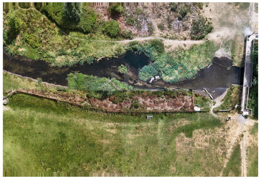
Orthomosaic of a chalk stream and its riparian corridorClick to enlarge

2D Orthomosaic Maps

PNG · PGW · KMZLicence

A top-down map stitched from nadir video and georeferenced with the flight telemetry. It comes with a PGW world file, so it opens in the right place in QGIS and ArcGIS, and a KMZ to drape it in Google Earth Pro.

Use it to: overlay the site on your existing GIS layers and sketch habitat boundaries or survey areas.

Read the orthomosaic guide →
Observation points and flight path in Google Earth ProClick to enlarge

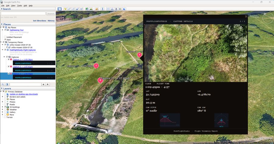
Google Earth Pro KMZ

KMZLicence

A KMZ package with clickable observation points - each opens the captured frame and its telemetry - plus the flight path with altitude and camera field-of-view cones.

Use it to: inspect georeferenced observations in Google Earth Pro and share them with people who have no GIS software.

Page from a PDF survey reportClick to enlarge

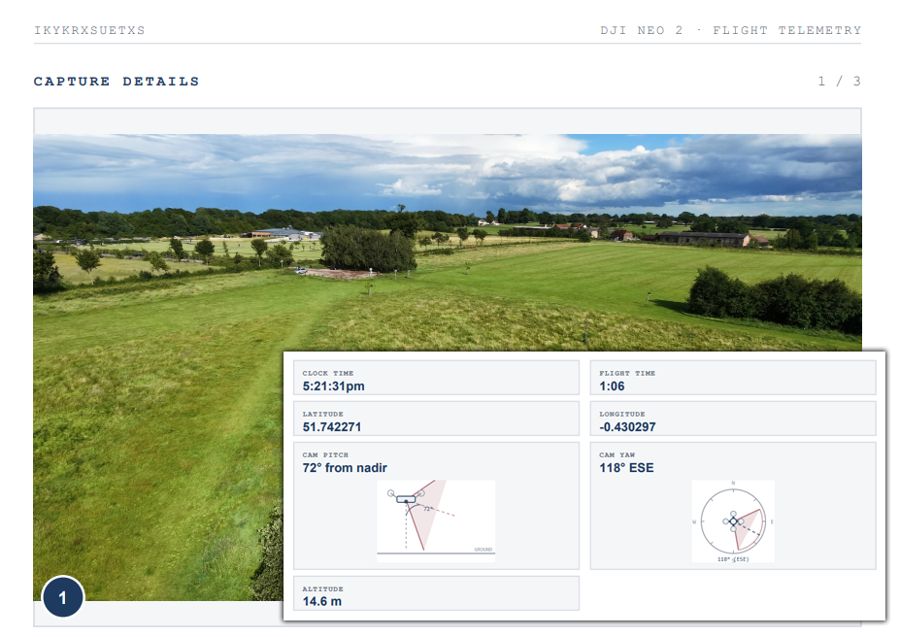
PDF Survey Reports

PDFLicence

A structured report with the survey boundary, key frame captures with their coordinates and camera direction, annotated observations and the flight log.

Use it to: show a client or project team what was covered and recorded on the visit, and file it as a dated site record.

Open an example report (PDF) →
Slide from a generated PowerPoint deckClick to enlarge

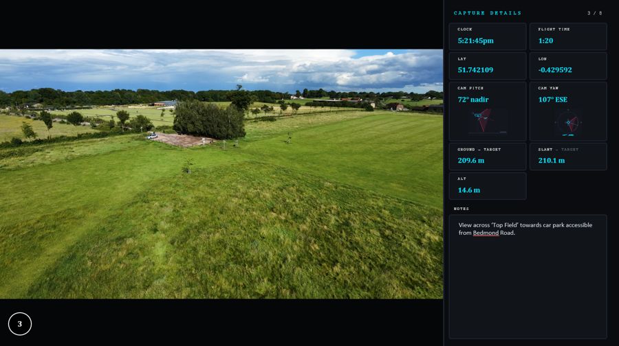
Presentation Decks

PPTXLicence

PowerPoint slides with a map overview, key frames and telemetry callouts - ready to present, or to edit like any other deck.

Use it to: brief stakeholders, landowners or volunteer groups without rebuilding slides by hand.

Download an example deck (.pptx) →

Highlight Videos

MP4Licence

Short clips around each captured frame, joined into one MP4 with an optional title, subtitle and background music. This example is a low-resolution web version.

Use it to: share a site visit on social media or open a presentation with real footage.

Full-resolution frame capture of a riverClick to enlarge

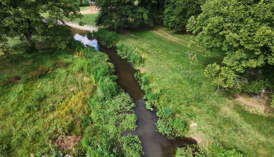
Raw Asset Bundles

ZIPLicence

Every captured frame at the video's full resolution, plus a CSV of the telemetry for each one, in a single zip file.

Use it to: keep the original evidence for records, reports or further analysis.

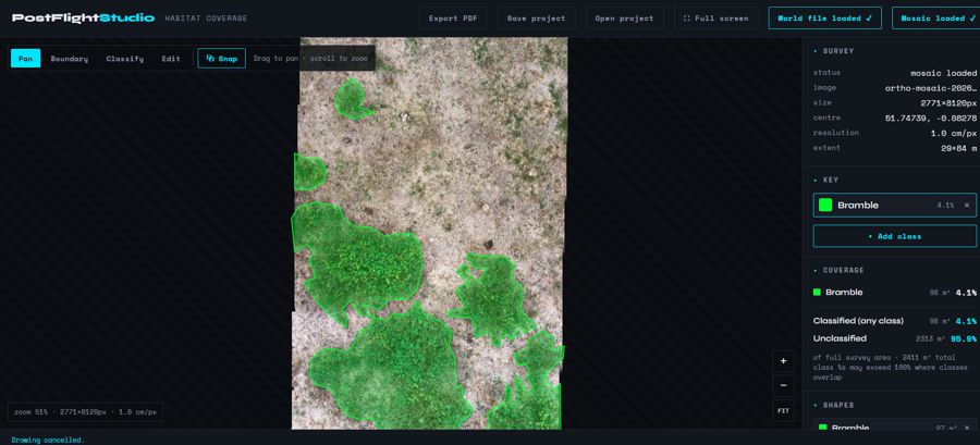
Habitat classes mapped over an orthomosaicClick to enlarge

Habitat Coverage

PDF · SHP · GeoJSONLicence

Map habitats over an orthomosaic: draw a survey boundary and classified areas with your own key, then get the area and percentage of each class and a PDF report. The boundary, areas and target notes export as Shapefiles for QGIS and ArcGIS - in British National Grid (EPSG:27700) for sites in Great Britain, or latitude and longitude elsewhere.

Use it to: measure habitat extent and track it across repeat visits.