
Case Study Overview: Broxbourne Wood Compartment 6
Managing designated Sites of Special Scientific Interest (SSSI) requires rigorous documentation of habitat mosaics, scrub regeneration, and open transitional zones. Traditionally, compiling these environmental baselines demands separate software for flight logging, GIS mapping, and presentation formatting.
Using a standard DJI drone, a single survey flight over Compartment 6 captured comprehensive aerial data. Rather than relying on external template formatting or uploading sensitive data to public servers, PostFlightStudio processed all 12,134 telemetry frames entirely locally in the browser.
One Flight. Multiple Environmental Deliverables.
Rather than repeating flights to collect different types of information, PostFlightStudio extracts multiple environmental outputs from the same MP4 and SRT flight data:
1. Interactive Telemetry Maps
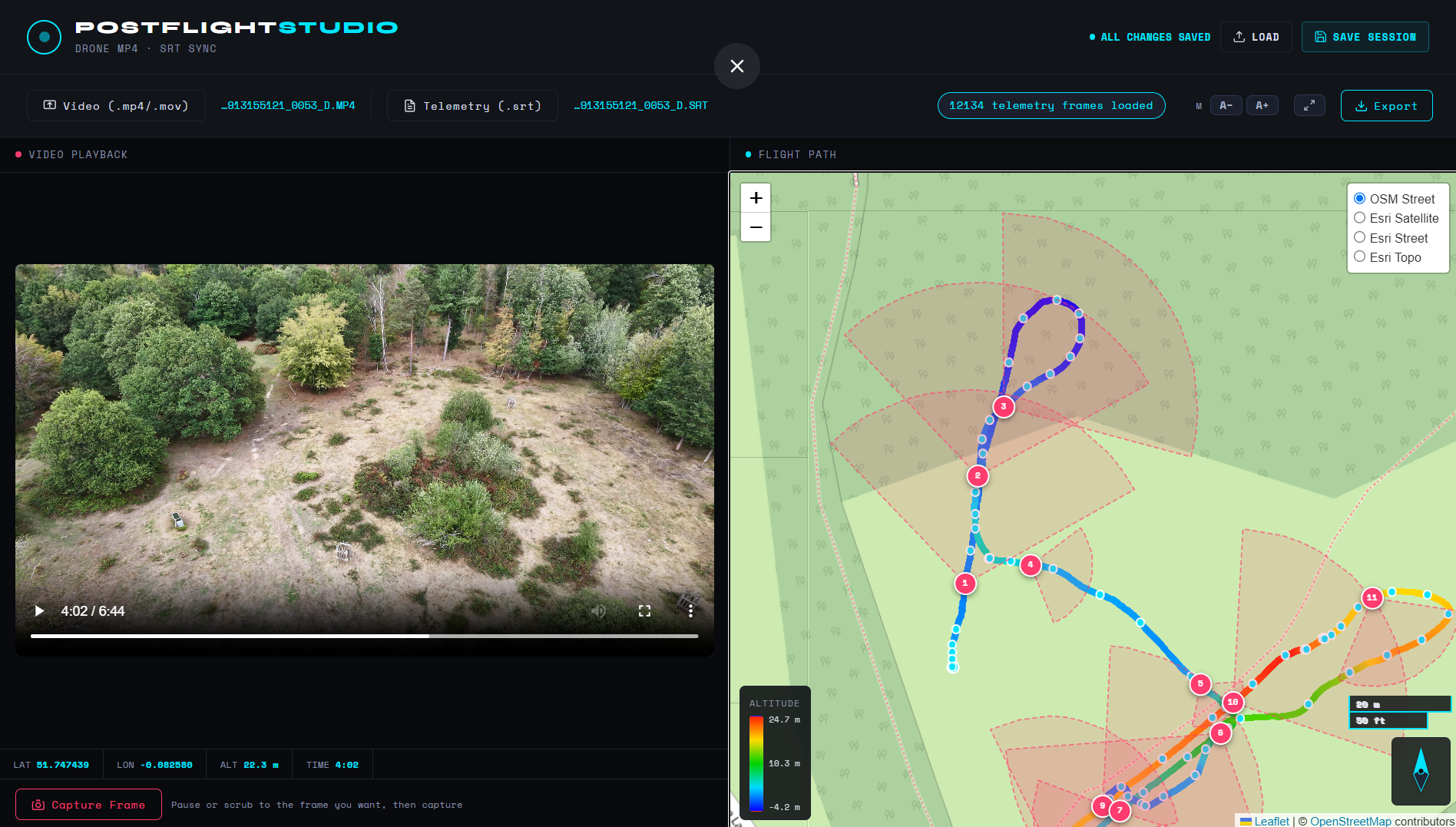
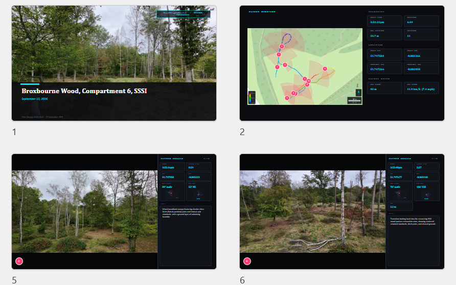
Links flight paths with altitude gradient overlays (ranging from -4.2 m to 24.7 m) and FOV cones. Click-to-jump video linking lets reviewers cross-reference any map waypoint with the exact video frame.
2. Quantitative Habitat Metrics
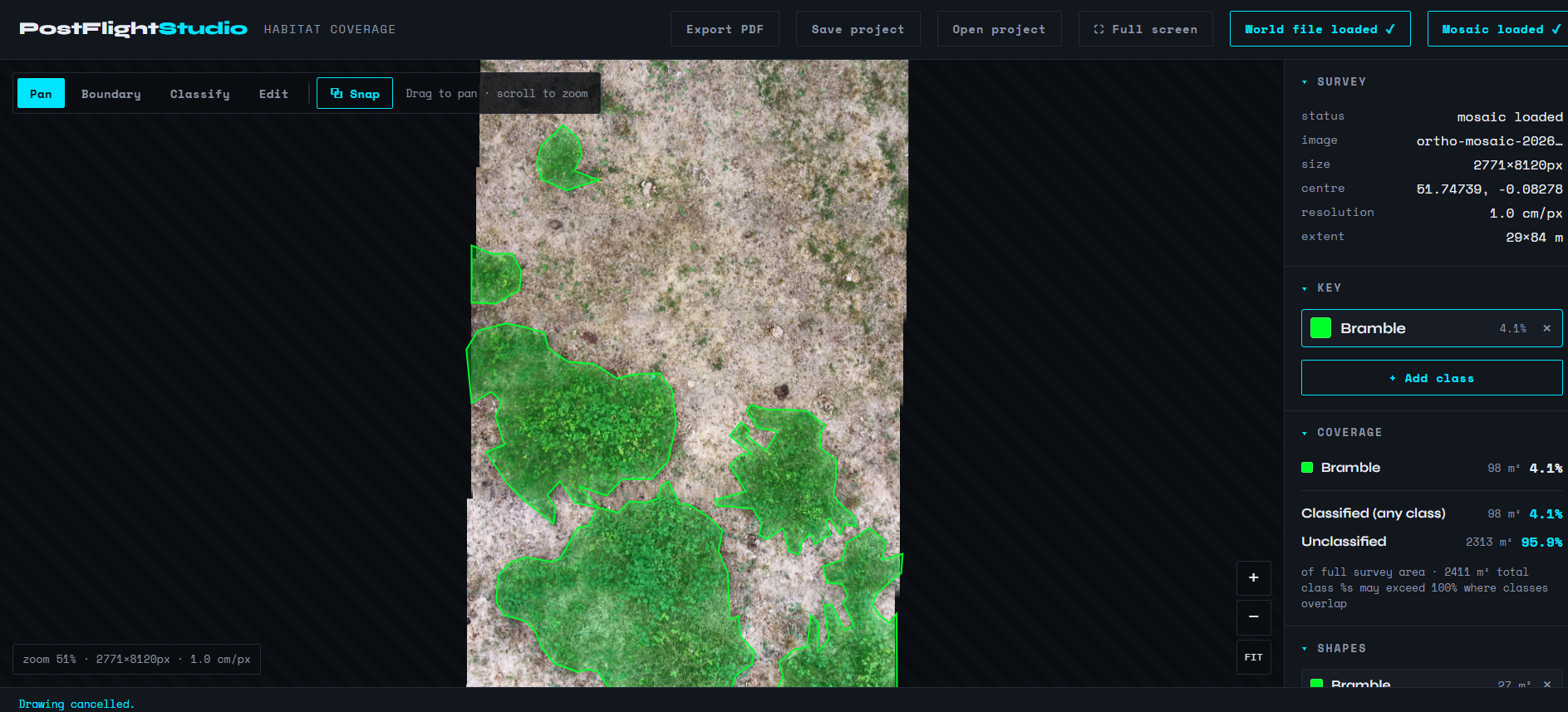
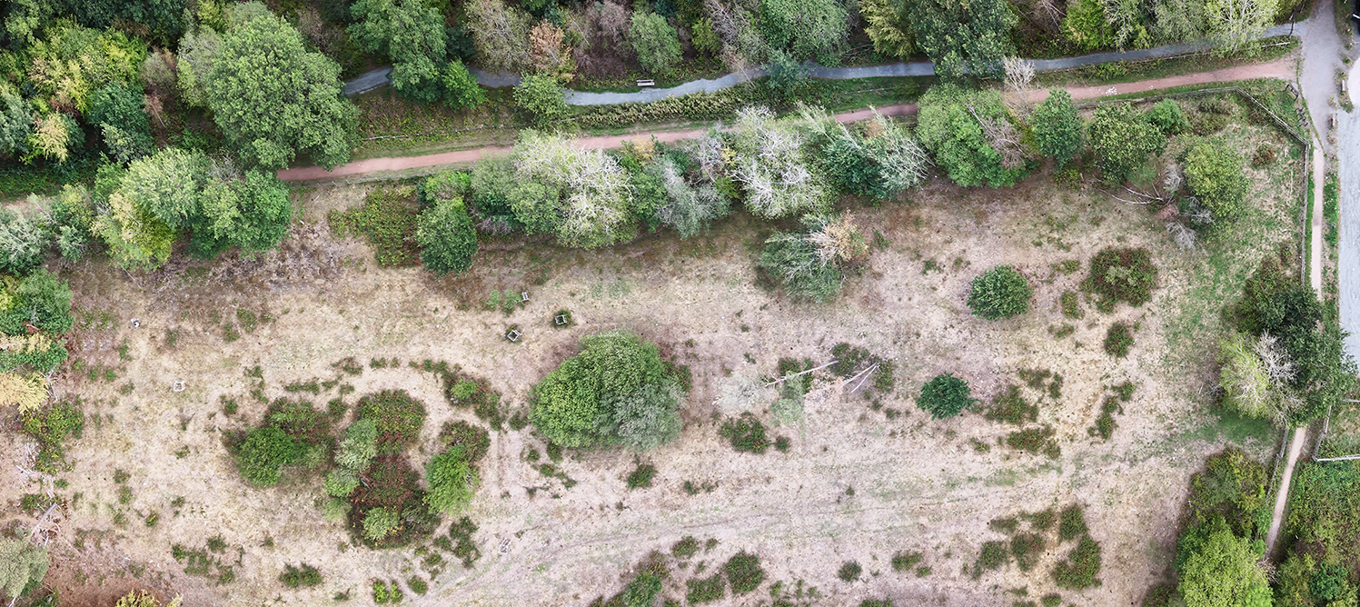
Extracts high-resolution orthomosaics (1.0 cm/px) that automatically calculate spatial class distributions—such as tracking Bramble coverage (98 m² / 4.1%) against unclassified matrix areas (2,313 m² / 95.9%).
3. Professional Reports & Slides
Compiles audit-ready PDF flight logs for project documentation and clean, client-ready `.pptx` slide decks for stakeholder review.
Visual Outputs & Interface Gallery
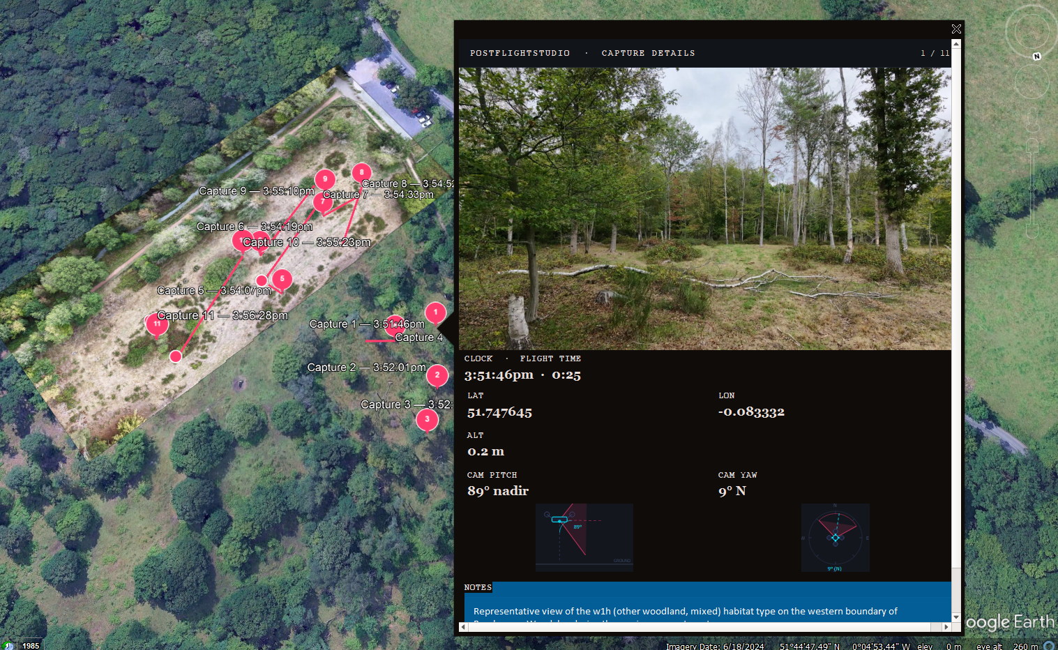
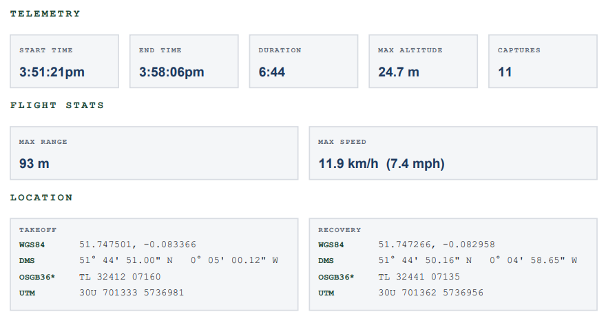
Explore thumbnails of the dashboard interface, high-resolution orthomosaics, site flight logging reports, Google Earth 3D exports, and presentation materials generated from the Broxbourne Wood workflow:
The Browser-Based Workflow
1. Select Local Files
Drop your MP4 video and SRT telemetry files straight into the browser. Everything remains securely on your machine.
2. Annotate Key Points
Scrub through the video, mark key observations, and compile slide decks with zero manual formatting required.
3. Export Deliverables
Export your completed flight logs, PowerPoint presentations, KMZ pins, and PDF baseline reports.
Keep Sensitive Survey Data on Your Machine
Environmental consultants may be working with commercially sensitive site data, client information, and imagery that they do not want uploaded to third-party services.
Because PostFlightStudio processes the data locally in the browser, the underlying survey files remain on the user's machine. Field teams can generate audit-ready reports on-site with complete confidence.
Frequently Asked Questions
By parsing standard MP4 and SRT telemetry files locally, PostFlightStudio generates multiple outputs from a single flight: interactive map playback with FOV cones, high-resolution orthomosaics, commercial flight logs, and structured presentations.
The generated PDF flight report provides essential commercial drone logging data including start/end times, duration, max altitude (24.7 m), max speed, takeoff and recovery coordinates in WGS84, DMS, OSGB36, and UTM formats, plus sequential waypoint inspection notes.
Yes. PostFlightStudio runs completely offline on your desktop. Because zero cloud uploads are required, sensitive SSSI boundary data, proprietary site notes, and telemetry remain strictly confidential under your local control.
PostFlightStudio structures your annotated video frames, timestamps, and telemetry metadata into a clean, client-ready `.pptx` slide deck, saving hours of manual formatting for stakeholder reviews.